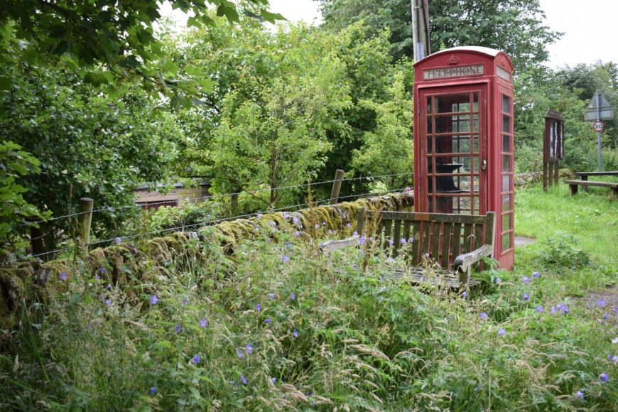
Hollinsclough, Staffordshire, SK17 0RQ
Date of visit: 13th July 2020
From Wikipedia, the free encyclopedia
Hollinsclough is a small rural village in the county of Staffordshire in the English Midlands. It is within the Peak District National Park.
Hollinsclough is on the upper reaches of the River Dove, at one end of a level area between the Dove and the River Manifold, not far from their sources on the eastern side of Axe Edge Moor. Here the Manifold flows through moorland on sandstone and various gritstones, before a conspicuous change at Hulme End, about 6 miles downstream, when the underlying rock changes to limestone. For all its length, the Dove marks the border between Staffordshire and Derbyshire. Not far downstream from Hollinsclough the Dove enters the limestone valley that ends in the famous Dovedale.
According to the English Place-Name Society, the name Hollinsclough comes from Howel’s ravine. Various documents, including tenancy records for the Manor of Haysgate in the County of Stafford, from 1651 to 1850 give the following variants of the name. Hollescloughe (1651), Holling Clough (1750), Hollingclough (1767), and The Liberty of Hollinsclough (1769).
Internal ref number: SF/119/076
Date of Visit: 13th Jul 2020
Kiosk Type: K6
Door Type: C
Crown: Tudor
Kiosk Colour: Red
Usage: Empty
Phone Number (if known): ex 01298 83386
Northing & Westing: 53Β°11’44.3″N, 1Β°54’13.6″W
what3words: saturate.emphasis.dads
Grid Reference: SK 06526 66509
OS X & Y: 366509, 406526
Latitude & Longitude: 53.195626, -1.903775
UK Postcode: SK17 0RQ
County: Staffordshire
Listed Status: