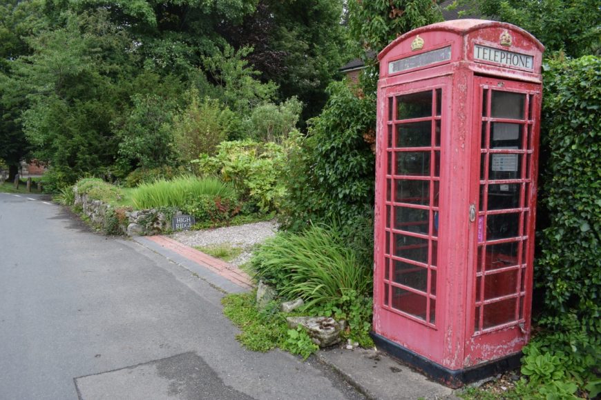
Marchington, Staffordshire, ST14 8LH
Date of visit: 13th July 2020
From Wikipedia, the free encyclopedia
One of the earliest mentions of Marchington the place is in an manuscript held in the British National Archives; A.D. 951. King Eadred to Wulfhelm, miles; grant of land at Marchington, Staffs. Later on Marchington is mentioned in the Domesday book where it is listed amongst the lands given to Henry de Ferrers by the King. The land consisted of four and a half square leagues of woodland and meadow; 40 acres (160,000 m2) of pasture and work for more than seven ploughs. It was worth one hundred shillings. The lands remained in the ownership of the de Ferrers family as part of the earldom of Derby until the failure of the rebellion of Robert de Ferrers, 6th Earl. After his death in 1279, his widow, Eleanor, failed in a legal case to prove that she had a dower interest in the land. The lands were then held by the king’s brother, Edmund, 1st Duke of Lancaster.
Marchington is 270 feet (82 m) above sea level. Marchington lies adjacent to the River Dove which also marks the border between Staffordshire and Derbyshire. There is also a small brook in the village, towards the River Dove there is a flood plain. Toot Hill lies to the North West and Hound Hill to the East. The National Forest also lies nearby, to the south of the village.
Internal ref number: SF/128/107
Date of Visit: 13th Jul 2020
Kiosk Type: K6
Door Type: D
Crown: Tudor
Kiosk Colour: Red
Usage: Phone
Phone Number (if known): 01283 820203
Northing & Westing: 52Β°52’32.7″N, 1Β°48’04.7″W
what3words: little.handy.masks
Grid Reference: SK 13471 30937
OS X & Y: 330937, 413471
Latitude & Longitude: 52.875741, -1.801301
UK Postcode: ST14 8LH
County: Staffordshire
Listed Status: Historic Eng. Ref. 1271151 28/11/2000