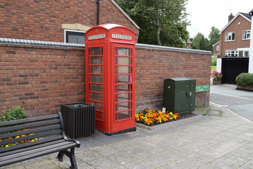
Brewood, Staffordshire, ST19 9DT

Brewood, Staffordshire, ST19 9DT

Date of visit: 29th July 2020

From Wikipedia, the free encyclopedia
Brewood is an ancient market town and civil parish in South Staffordshire, England. Located around grid reference SJ883088, Brewood lies near the River Penk, eight miles north of Wolverhampton city centre and eleven miles south of the county town of Stafford. Some three miles to the west of Brewood is the border with the county of Shropshire.

The Norman Domesday Book documented the town as ‘Breude’. The name is probably a compound made up of a Celtic, Brythonic word with an Anglo Saxon, Old English word.

The first element is the British word ‘briga’, which appears in modern Welsh as ‘bre’. This is the most common of a number of Celtic place-name elements signifying a hill. The second element is probably obvious: the Anglo-Saxon ‘wudu’, signifying a wood. Hence the name Brewood means either “Wood on or by a hill” or “Wood near a place called Bre”.


Internal ref number: SF/127/020

Date of Visit: 29th Jul 2022

Kiosk Type: K6
Door Type: A
Crown: Tudor
Kiosk Colour: Red
Usage: Phone
Phone Number (if known): 01902 850320

Northing & Westing: 52Β°40’38.3″N, 2Β°10’37.5″W
what3words: museum.vets.fingertip
Grid Reference: SJ 88123 08859
OS X & Y: 308859, 388123
Latitude & Longitude: 52.677299, -2.177094
UK Postcode: ST19 9DT
County: Staffordshire


Listed Status: Historic Eng. Ref. 1039308 10/10/1989