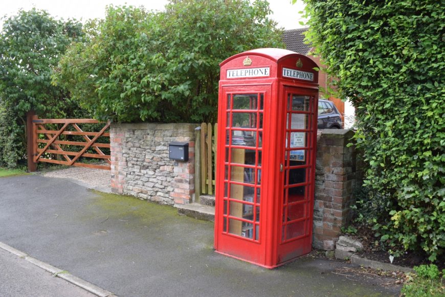
Syerston, Nottinghamshire, NG23 5ND

Syerston, Nottinghamshire, NG23 5ND

Date of visit: 26th August 2020

From Wikipedia, the free encyclopedia
Syerston is a small Nottinghamshire parish about six miles south-west of Newark-on-Trent, which is bisected by the A46 trunk road. It contains 179 inhabitants in seventy-three households (2011) which are almost all in a settlement to the east of the road. The parish is bounded on the north-east by Elston, on the south-east by Flintham and to the east by Sibthorpe. Its southern boundary is the supposed pre-historic trackway called Longhedge Lane.

The place appears as Sirestune in the Domesday Survey of 1086 and as Sireston juxta Stok (i.e. …’next to Stoke’) in the Assize Rolls of 1278. Scholars are in agreement that the name means the farm or settlement of someone called Sigehere, from an Old English personal name.


Internal ref number: NT/129/141

Date of Visit: 26th Aug 2020

Kiosk Type: K6
Door Type: D
Crown: Tudor
Kiosk Colour: Red
Usage: Book
Phone Number (if known):

Northing & Westing: 53Β°01’06.3″N, 0Β°53’08.5″W
what3words: sulked.onlookers.lunging
Grid Reference: SK 74848 47372
OS X & Y: 347372, 474848
Latitude & Longitude: 53.018421, -0.885697
UK Postcode: NG23 5ND
County: Nottinghamshire


Listed Status: