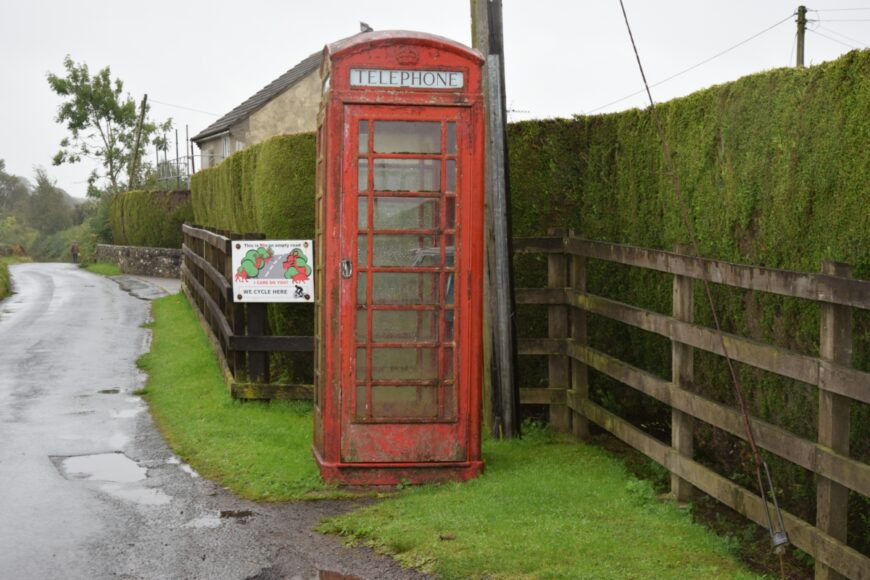
St. Briavels, Gloucestershire, GL15 6SE

St. Briavels, Gloucestershire, GL15 6SE

Date of visit: 30th Sept 2021


From Wikipedia, the free encyclopedia
St Briavels (pronounced Brevels, once known as ‘Ledenia Parva’ (Little Lydney)), is a medium-sized village and civil parish in the Royal Forest of Dean in west Gloucestershire, England; close to the England-Wales border, and 5 miles (8 km) south of Coleford. It stands almost 800 feet (240 m) above sea level on the edge of a limestone plateau above the valley of the River Wye, above an ancient meander of the river.

Little is known about the origin of St Briavels. The name is thought to be from a much-travelled early Christian missionary, Brioc, whose name also appears in places as far afield as Cornwall and Brittany.

Later King Offa of Mercia built Offa’s Dyke from the mouth of the River Wye near Chepstow to Prestatyn and local remains can still be seen in the nearby Hudnalls Wood. The Normans thought it an ideal site for one of the many castles built from Chepstow to Chester to check the intrusion of the warlike Welsh tribesmen from the Welsh Kingdom of Gwent into the more peaceful areas east of the Severn and Wye rivers. At Windward, the highest point in the parish, the land rises to 800 feet (240 m) above sea level; St Briavels Castle itself is somewhat lower at 600 feet (180 m) and nestles into the hillsides, with a commanding view of the Wye Valley between Tintern and Redbrook.

Internal ref number: GL/162/352

Date of Visit: 30th Sep 2021

Kiosk Type: K6
Door Type: D
Crown: Tudor
Kiosk Colour: Red
Usage: Empty
Phone Number (if known): EX 01594 530307

Northing & Westing: 51Β°43’48.2″N, 2Β°39’11.3″W
what3words: jumps.harmonica.products
Grid Reference: SO 54987 03683
OS X & Y: 203683, 354987
Latitude & Longitude: 51.730043, -2.653148
UK Postcode: GL15 6SE
County: Gloucestershire


Listed Status: