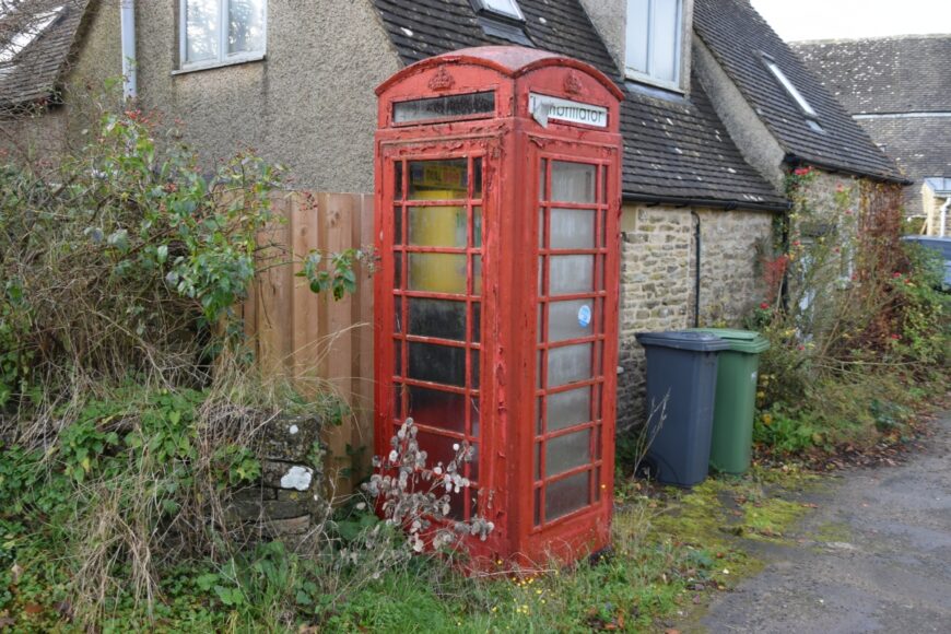
The Camp, Gloucestershire, GL6 7HL
Date of visit: 18th Nov 2021
From Wikipedia, the free encyclopedia
The Camp is a hamlet in the south of Gloucestershire, approximately 10 miles south of Cheltenham and 5 miles north-east of Stroud. It is in the parish of Miserden, a village about 2 miles east of The Camp.
The village clusters around two roads: Calf Way and Honeycombe Road. Calf Way is thought to be a Roman road, presumably named for the cattle driven along it. Honeycombe Road leads to Honeycombe Farm, and then on to Miserden.
How the village came to be known as The Camp is a matter of debate. Some sources claim that it is related to Neolithic camps β and there are the remains of Neolithic burial chambers close to the village. Others claim that it was a Civil War encampment. In either case, at some point before 1767, the village was known as Hazlehouse-Yate. Hazle House is a large house close to the village; “yate” means gate.
Internal ref number: GL/163/382
Date of Visit: 18th Nov 2021
Kiosk Type: K6
Door Type: D
Crown: Tudor
Kiosk Colour: Red
Usage: Defrib
Phone Number (if known):
Northing & Westing: 51Β°46’57.2″N, 2Β°07’34.3″W
what3words: shirtless.quiz.ally
Grid Reference: SO 91391 09328
OS X & Y: 209328, 391391
Latitude & Longitude: 51.782544, -2.126199
UK Postcode: GL6 7HL
County: Gloucestershire
Listed Status: