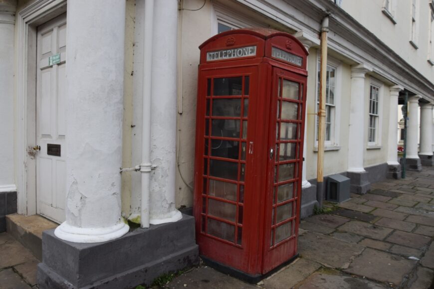
Wallingford, Oxfordshire, OX10 0LE

Wallingford, Oxfordshire, OX10 0LE

Date of visit: 28th Dec 2021


From Wikipedia, the free encyclopedia
Wallingford is a historic market town and civil parish located between Oxford and Reading on the River Thames in England. Although belonging to the historic county of Berkshire, it is within the ceremonial county of Oxfordshire for administrative purposes (since 1974) as a result of the 1972 Local Government Act. Wallingford is 12 miles (19 km) north of Reading, 13 miles (21 km) south of Oxford and 11 miles (18 km) north west of Henley-on-Thames. The town’s population was 11,600 in the 2011 census.

The town has played an important role in English history starting with the surrender of Stigand to William the Conqueror in 1066, which led to his taking the throne and the creation of Wallingford Castle. The castle and the town enjoyed royal status and flourished for much of the Middle Ages. The Treaty of Wallingford, which ended a civil war known as The Anarchy between King Stephen and Empress Matilda, was signed there. The town then entered a period of decline after the arrival of the Black Death and falling out of favour with the Tudor monarchs before being called on once again during the English Civil War. Wallingford held out as the last remaining Royalist stronghold in Berkshire before surrendering after a 16-week siege. Fearing that Wallingford Castle could be used in a future uprising, Oliver Cromwell ordered its destruction.

Internal ref number: ON/164/124

Date of Visit: 28th Dec 2021

Kiosk Type: K6
Door Type: B
Crown: Tudor
Kiosk Colour: Red
Usage: Phone
Phone Number (if known): 01491 835333

Northing & Westing: 51Β°35’58.9″N, 1Β°07’29.1″W
what3words: embedded.simulator.nature
Grid Reference: SU 60718 89344
OS X & Y: 189344, 460718
Latitude & Longitude: 51.599679, -1.124761
UK Postcode: OX10 0LE
County: Oxfordshire


Listed Status: Historic Eng. Ref. 1048489 09/05/1988