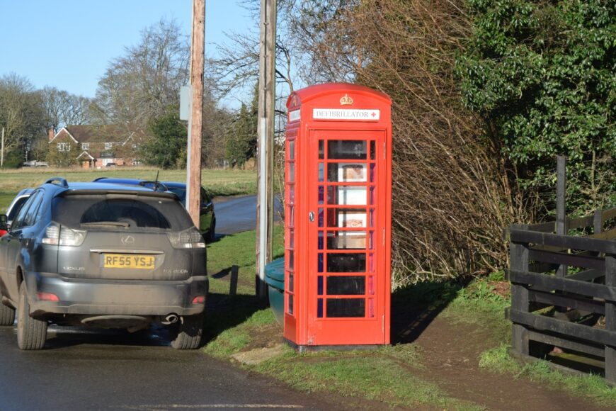
Rotherfield Peppard, Oxfordshire, RG9 5JU
Date of visit: 12th Jan 2022
From Wikipedia, the free encyclopedia
Rotherfield Peppard (often referred to simply as Peppard by locals) is a village and civil parish in the Chiltern Hills in South Oxfordshire. It is centred 3 miles (5 km) west of Henley-on-Thames, 4+1β2 miles (7 km) north of Reading, Berkshire and 1 mile (1.6 km) southwest of Rotherfield Greys.
Rotherfield derives from the Old English redrefeld meaning “cattle lands”. In the middle of the area is the open-to-the-public land, Peppard Common, once used for grazing and which can be used by parishioners for small timber.
Internal ref number: ON/175/102
Date of Visit: 12th Jan 2022
Kiosk Type: K6
Door Type: B
Crown: Tudor
Kiosk Colour: Red
Usage: Defrib
Phone Number (if known):
Northing & Westing: 51Β°31’45.8″N, 0Β°58’38.7″W
what3words: trump.warmers.pollution
Grid Reference: SU 71031 81660
OS X & Y: 181660, 471031
Latitude & Longitude: 51.52939, -0.977432
UK Postcode: RG9 5JU
County: Oxfordshire
Listed Status: