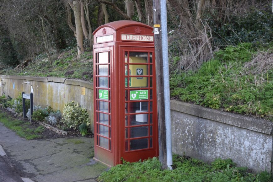
South Ferriby, Lincolnshire, DN18 6HZ

South Ferriby, Lincolnshire, DN18 6HZ

Date of visit: 10th Feb 2022


From Wikipedia, the free encyclopedia
South Ferriby is a village in North Lincolnshire, England. It is situated on the south bank of the Humber Estuary and 3 miles (5 km) west from the Humber Bridge. North Ferriby is directly opposite on the Estuary’s north bank. Village population was 651 in 2011.

South Ferriby dates back at least to Roman times when there was a major settlement. It is known locally as one of the ‘Low Villages’ at the bottom of a chalk escarpment, where the chalk meets the clay to give, before piped water, (the village was one of the first to have piped water with houses plumbing into the supply which was put down to supply steam ships) to the a plentiful water supply. It also marks the point where the Lincolnshire Wolds meet the Humber Estuary and was, as the name suggests, the southern end of an ancient ferry over the Humber to North Ferriby. The entry in the Domesday Book of 1086 records a church, a mill and two ferries. To sustain two ferries suggests that a prosperous trading community must have been flourishing at the time.

Internal ref number: LL/106/243

Date of Visit: 10th Feb 2022

Kiosk Type: K6
Door Type: C
Crown: Tudor
Kiosk Colour: Red
Usage: Defrib
Phone Number (if known):

Northing & Westing: 53Β°40’32.9″N, 0Β°30’18.8″W
what3words: tiger.tributes.accented
Grid Reference: SE 98839 20965
OS X & Y: 420965, 498839
Latitude & Longitude: 53.675817, -0.505214
UK Postcode: DN18 6HZ
County: Lincolnshire


Listed Status: